Changing Arctic Landscape reminds us that the disappearance of glaciers increases the rate of climate change because the white surface of the glaciers can no longer reflect heat back into the atmosphere. When glaciers melt, the heat and additional CO2 is instead trapped in the atmosphere or absorbed by the oceans.

Large white surfaces - like this one at Exit Glacier near Seward - reflect heat instead of it being absorbed into the atmosphere.
John E. Walsh of University of Alaska explains the effects of degrading permafrost – increased erosion and dying trees. Melting permafrost releases CO2 into the atmosphere, which increases temperatures and will, of course, lead to more melting permafrost.
Warmer temperatures also lead to larger insect populations like spruce beetles. Gary Stevik of Chickaloon, Alaska explains that conifers that are already weakened by the effects of melting permafrost make easy prey for these insects, which feed on the bark and leaves of trees, ultimately killing them.

When these trees die, their roots can no longer absorb water or hold soil in place. As a result, more erosion occurs, which leads to more dying trees. The dead trees are dry; this makes fire danger much higher. Burning forests release more CO2 into the atmosphere, causing – in a vicious cycle – more global warming.
Losing Permafrost explains that much of Alaska is built on a layer of frozen ice and soil that has existed since the last ice age – more than 10,000 years! In Interior Alaska, the winter average temperature has risen by 4 degrees C since the 1960s, causing the permafrost to melt at alarming rates.
I like the connections to native culture in this video. The interviews with Alaskans such as the Huslia residents in the Interior make the information more real. Melting permafrost causes lakes to drain into rivers, which forces beavers and fish to abandon their homes and makes fewer resources available for those who depend on the subsistence lifestyle.
Building and road damage is also occurring due to the melting permafrost. I was shocked to learn that repairing the damage costs Alaskans about $35 million a year! There is no evidence that the rate of climate-warming and permafrost-melting will lessen unless we, as a society, follow the example of Evon Peter and Arctic Village, Alaska, and decrease our use of fossil fuels.

Damage caused by melting permafrost costs Alaskans $35 million a year!
Damage caused by melting permafrost costs Alaskans $35 million a year!
Earth's Cryosphere: The Antarctic explains that despite being on the driest place in the world, Antarctica contains 70% of the world’s water – locked up in ice! I like the video footage that zooms over the satellite images of the various glaciers. One of the largest, the Ross Glacier, is the size of Florida.
As temperatures increase, melt ponds have begun to dot the Antarctic landscape. As the melt water slips into cracks, ice shelves are slowly weakened and will ultimately collapse. The Larsen B ice shelf collapsed in five weeks after begin around for 12,000 years!

Sea ice forms when the ocean freezes, pushing the salt down underneath the ice. The salty, cold water sinks down according to convection patterns. This powers ocean currents, which influence worldwide climate.
· Explore Antarctica is an excellent resource. Students can learn about oceanography and virtually join a science expedition of the continent, as well as learn about the wildlife of Antarctica.

The Glacier Bay National Park website has some great links and resources for teachers. Even the coloring books, like the Pacific Salmon and Steelhead Coloring Book, have some great reading passages for students. These explain not only biological information about the salmon/steelhead and their lifecycles, but also how the fish are linked to the rest of the ecosystem, including humans! (By the way, it is 54.95 miles from Glacier Bay to Hoonah, Alaska according to Google Earth.)

Glacier Bay National Park
Glacier Bay National Park
This website also highlights the Alaska Seas and Rivers Curriculum. I have used this resource in my classroom for elementary and middle school science students, and it in incredible! I especially like this 3rd grade unit on water sheds – including the cyrosphere – and this 8th grade unit on climate change.
The Alaskool Website also has some incredible resources. Under the education and curricula tabs, I found some great units. One of my favorite was the Cup’ik People of the Western Tundra by John Pingayak. NWABSD Alaska Studies Social Studies Curriculum also has some good lesson ideas, but the resources are not online, so I am worried some may be difficult to find.
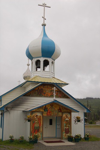
I like this site on the Russian Church and Native Alaskan Cultures. It is particularly relevant in the Homer area because we have four Russian Orthodox villages, all with KPBSD schools. The school I teach at is 5 miles from Nikolaesvk village, and there are several Russian Orthodox students in my classes, so I make sure to integrate their culture, too, whenever possible.
The information on water distribution presented on USGS website is interesting! A great visual for students would be to have them create this with 1,000 real water droplets.
Using the analogy that 1,000 drops of water represent all of the water on Planet Earth:
- 972 drops are in the oceans and inland seas
- 21 drops are in glaciers
- 6 drops are in ground water and soil moisture
- Less than 1 drop is in the atmosphere
- Less than 1 drop is in lakes and rivers
- Less than 1 drop is in all living plants and animals
The information on glacier locations is also interesting. There sure aren’t many in Alaska, relatively speaking!
Using the analogy that 1,000 ice crystals represent all of the glacier ice on Earth, the global distribution of ice is:
- 914 crystals are in Antarctica
- 79 crystals are in Greenland
- about 4 crystals are in North America (with about 1 crystal is in Alaska)
- about 2 crystals are in Asia
- less than 1 crystal is in South America, Europe, Africa, New Zealand and Irian Jaya
I like NASA’s earth observatory data with monthly images of the cyrosphere from Feb 2000-2010. In order to not get lost in all these images, it might be a good activity to have students compare, say, Januarys 2000-2010 or Julys 2000-2010 and see what changes are occurring.
Tanana River Breakup 2009, Ice Breakup on the Nenana River, Breakup on the Yukon in Galena, Alaska all have some nice footage. These are some good resources to remember to have students give some thought to river break-up, and also to have them experience other parts of Alaska. The excitement of the viewers is very evident in the audio!
Students Measure Changes in Lake Ice and Snow is good resource for inspiring students with ideas for how they can get involved in science and end up making a difference in their community. The kids were able to measure and research snow density, ice thickness, thermal conductivity, and temperature gradients and then relate these directly to climate change.
The Tunnel Man resources are hilarious. I love the diagrams that explain the lyrics to the songs – especially the tweaked buildings. They are informative. The teacher would need to utilize the pause button with these, I think, to periodically discuss what the lyrics mean and make sure students are understanding. It would be great to have copies of the lyrics.
3 Colleagues
Matt Hunter’s Alaskan Knowledge
The study done by Biologists Ted Schuur and Jason Vogel at the University of Florida was interesting. Despite the new plant growth encouraged by cynobacteria’s creation of nutritious soil, the plants cannot absorb enough CO2, especially during the winter months and significant amounts are still being released into the atmosphere. I also like the lines he uses to separate your paragraphs – great presentation!
Cheryl Williams’s Explore Palmer
Wow – what an opportunity to go to Norway for a polar science conference. I like your idea bringing first explorers into the cultural connections part of your units.
Students Measure Changes in Lake Ice and Snow is good resource for inspiring students with ideas for how they can get involved in science and end up making a difference in their community. The kids were able to measure and research snow density, ice thickness, thermal conductivity, and temperature gradients and then relate these directly to climate change.
.
Amy Peeke’s Explore Alaska Blog
I love that her students are so aware of their environment on St Lawrence Island. That they can articulate the changes they have seen over their lifetime is incredible! It must be so fun working with a group of observant young scientists. I hope they get to record the dates and temperature for when the lake and ocean on either side of the Gambell runway freeze.
No comments:
Post a Comment